Survey scan data modelling
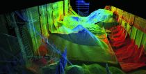
Improvements to Maptek’s I-Site Studio 3.3 laser scan modelling software are designed to streamline routine mine surveying tasks. A new global registration tool uses a single step process to register multiple scans and objects together. This saves time for surveyors, who previously had to match pairs of objects/data. I-Site Studio 3.3 (Fig.) incorporates many user suggestions - for example, surveyors have specifically asked to be able to label elevations on generated contour lines – a standard mapping task made even easier. I-Site Studio is sold bundled with Maptek laser scanners, or as a standalone modelling package.
www.maptek.com


